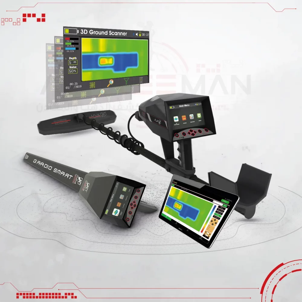


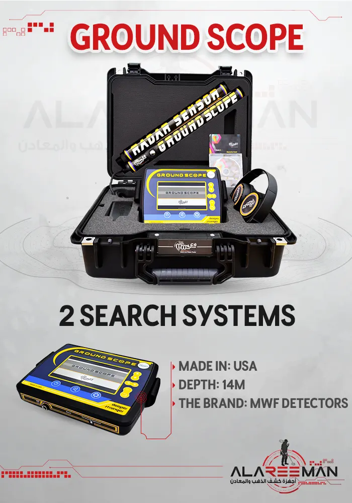
Ground Scope
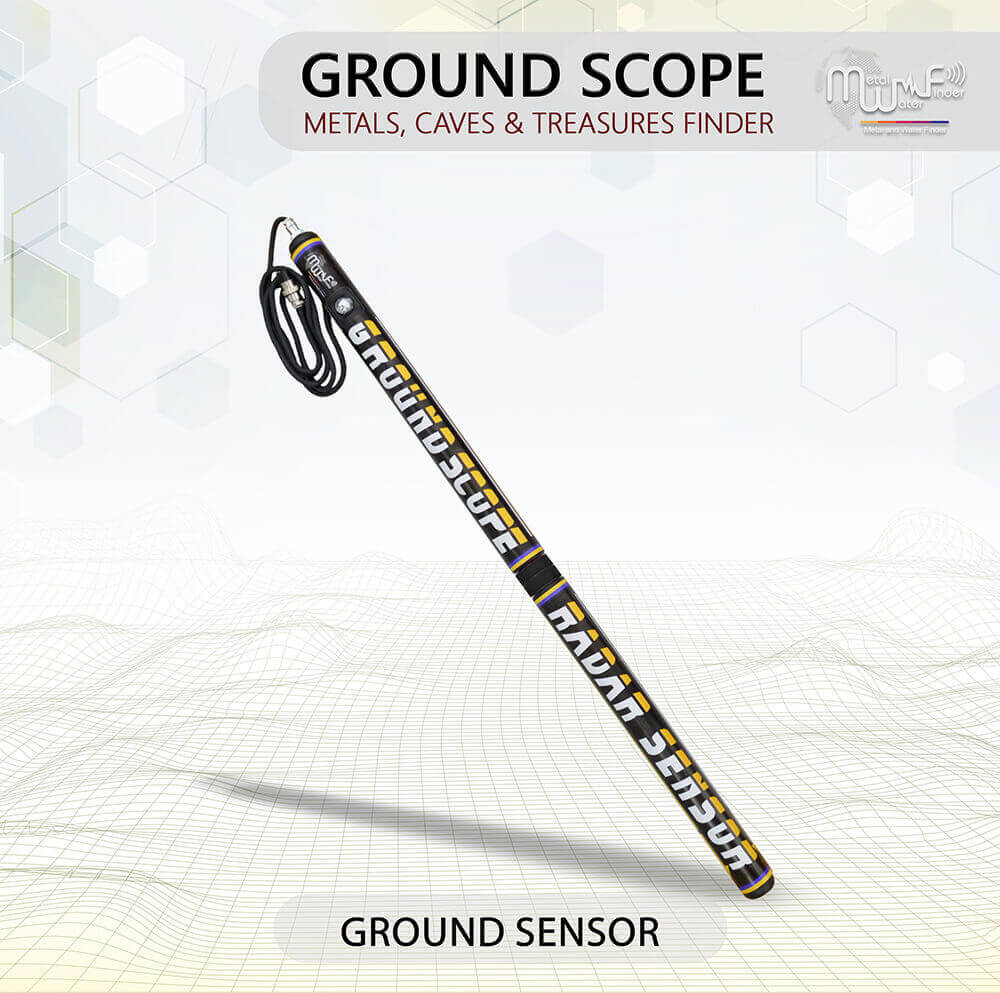
• This system scans soil layers to identifies their contents and reads levels of electromagnetic fields and radiations to detect the locations of metal, treasures and caves underground.
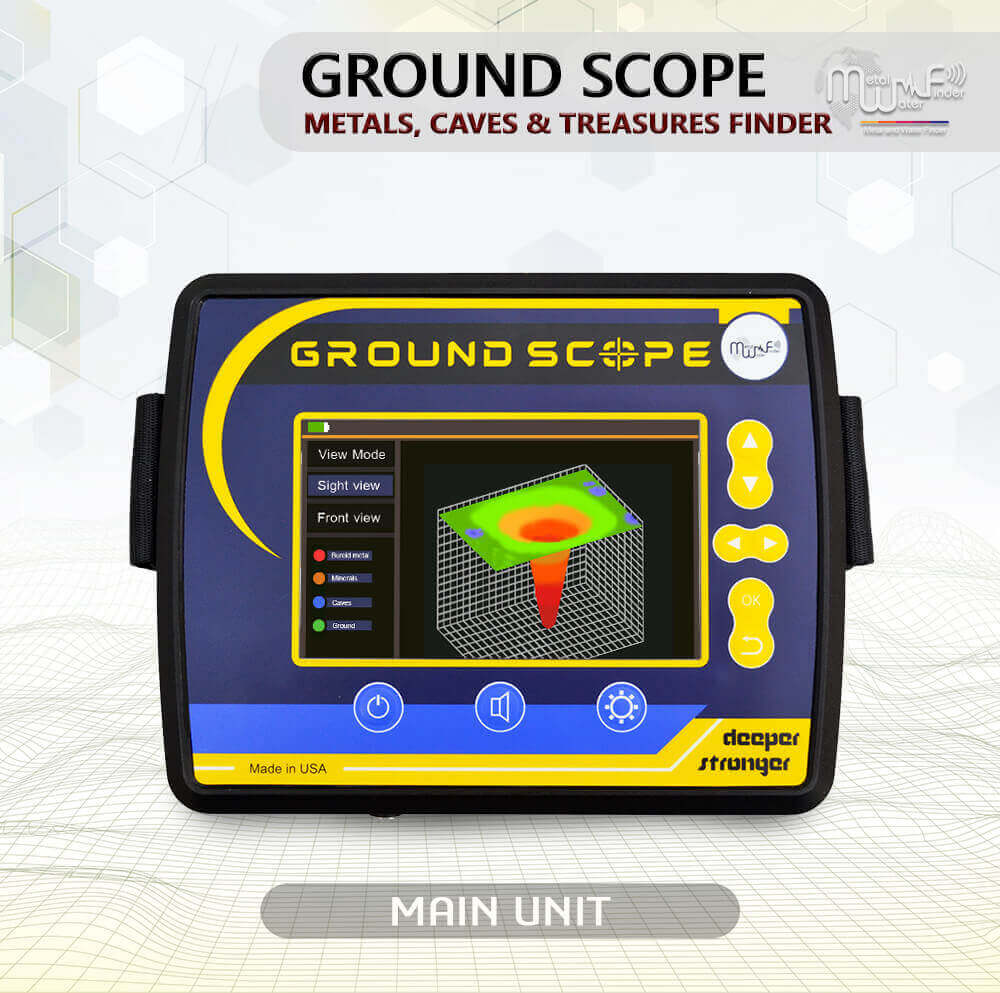
• A smart interface gives the user absolute clarity and integrated results about the targets and their locations in real time.
• Accurate discrimination system between a target.
• Oscilloscope graphics system to determine the target size and the beginning and end points.
• Interactive sound indicators associated with graphic data.
• Ground scan system: This system allows the user to perform a complete survey of the area to be detected and clarify the results of the scanning in the real time on the device screen and determine the value and identity of each point and detection the depth range at the same time, in addition to providing a 2&3 dimensional report of the detected target, with more than one view angle .
Features of the Ground Scope device
• Ground Scope works by very sophisticated smart detection technologies and software, It scanning the ground layers to check and search for buried metal or caves through the radar sensor it sends the received values to the main unit, In order for the device in turn to process the data and display on the device screen with 2 and 3D view.
• Specialized to detects objectives underground, distinguish between them through different colors and numerical values at the same time, and shows the shape of the target underground as well.
• Determines the depth automatically of all scanned points and shows the depth value of each point directly on the screen.
• The device working by two detection and exploration systems:
– Live Scan system: This system gives the user direct imaging of the ground layers to detect a metal, caves and distinguish between them and monitor their location in real time and broadcast live in the device screen immediately.
– Ground Scan ( 2D&3D Data )